
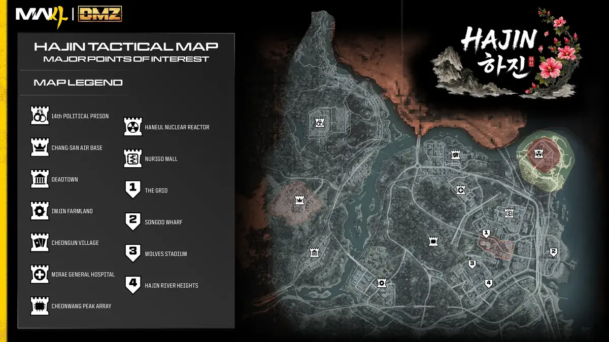
The Hajin map in Call of Duty: Modern Warfare 4’s Demilitarized Zone (DMZ) mode offers a vast, dynamic landscape with varied threat levels and strategic points for players to explore. Here’s how the grid system works, what "threat" means on this new battlefield, and an overview of key locations.
The MW4 DMZ Hajin map brings former North Korean territory in the west together with South Korean districts, including Hajin City. Russia lies across the river to the north, but that territory is currently inaccessible. The western military sites, central high ground and eastern city districts contain 13 major areas, with smaller settlements, fortifications and service points between them.
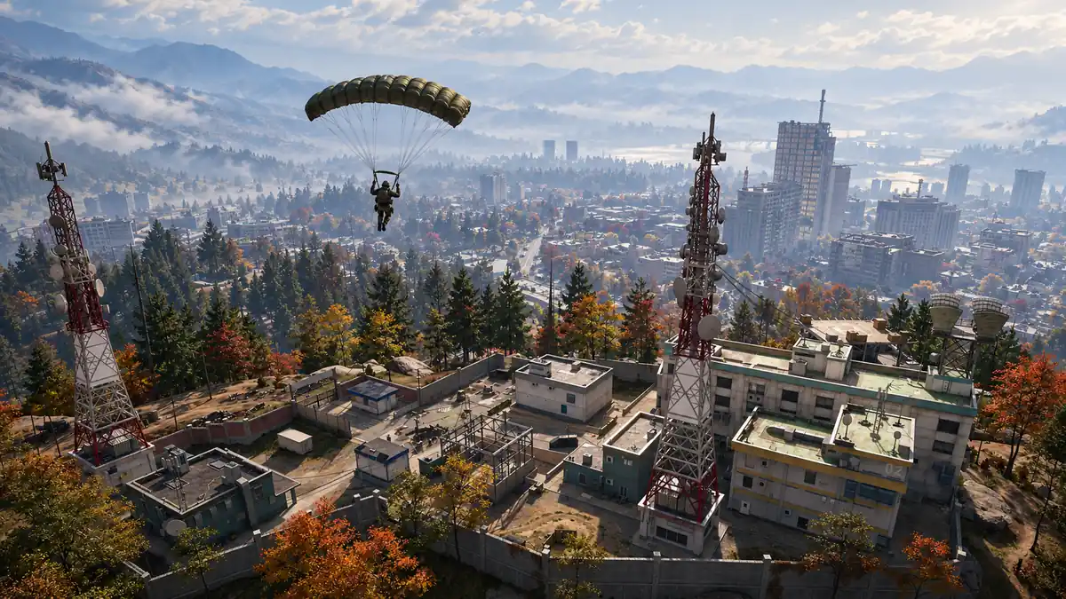
Map Orientation & Grid System
The Hajin map uses a letter-number coordinate system: letters run west-to-east, while numbers go north-south. For example, the Imjin Farmland area is located at D7. Keys also include a relevant grid location in their descriptions, giving you an area to search rather than necessarily identifying the exact door.
The official Hajin map provides numeric X/Y pin coordinates for key locations, but these are website map positions rather than physical distances or in-game grid cells. PortalSpin’s location pages also use website reference squares. For a key or an in-match objective, use the coordinates on your game’s Tac-Map.
On that Tac-Map, you can inspect objectives, named places, Compounds, useful buildings, Ammo & Armor Caches and radiation, alongside your position and squad pings. The named districts give you broad orientation; the building and service icons help you decide where to go within or between them.
Threat Levels Explained
Starting threat levels are indicated below the on-screen compass: Low, Medium, High, Critical and Extreme. Breaking contact with AI forces can reduce their aggression. However, this system doesn’t account for human players; you might encounter rival Operators regardless of the displayed rating.
The official Hajin guide describes higher threat as more numerous and dangerous enemies, with further reinforcements possible as combat escalates. A starting rating is useful for choosing an area, but it does not promise that a prolonged fight will remain at that intensity.
Which areas have Low threat? Deadtown’s exterior, Imjin Farmland, Cheongun Village, Mirae General Hospital and Songdo Wharf are among the listed Low-threat areas. Smaller sites can differ sharply: the Prison Yard is High while its Citadel is Critical, and Chang-san Air Base is Critical above an Extreme-threat bunker. The ratings below stay with their named subjects; an unrated landmark does not automatically inherit its neighbour’s tier.
How big is Hajin compared with Al Mazrah?
The Hajin map is described by Activision as one of the largest in Call of Duty history, but a measured area or official numerical size ratio against Al Mazrah has not been established. The count of over 60 named places isn’t a direct measurement of physical area either.
Hajin also extends below ground in several districts. Surface outlines alone therefore leave out part of what you can explore, particularly around the Air Base, Casino and Mall. That makes a simple comparison of place names shown on the map a poor way to judge the amount of playable space.
Main Areas Overview
14th Political Prison
This northwestern plateau is beside a polluted river, with surrounding watchtowers. Inside, the prison yard starts at High threat. Its Critical-threat Citadel fortress includes walkways and cell blocks.
The main checkpoint and gate sit to the south, with barracks to the east. High concrete walls separate the cleared prison grounds from the surrounding terrain. Once inside, the Citadel’s elevated crossings and cell blocks give it a different layout from the open yard.
- Fortress Prison Yard: The High-threat yard inside the prison perimeter, surrounding the Citadel.
- Prison Citadel: A Y-shaped, Critical-threat fortress with gantries, steel walkways, a furnace and a maze of cells.
Chang-san Air Base
Occupying a granite hillside in western North Korea, this area features a runway, a hospital, barracks, and missile bunkers. The surface is Critical threat; the Air Base Bunker beneath it is Extreme. Admin Complex No. 2 is a nearby fortress.
Cliffs rise to the east and elevated woodland sits to the south. The surface base also contains a helipad, depots and a command building, while smaller supply sites and a toxic containment pool occupy the surrounding ground. The underground complex sits beneath the southern hillside.
- Air Base Bunker: Large doors lead into an Extreme-threat bunker and tunnel complex under the southern hillside. The underground space is described as larger than the surface base.
- Admin Complex No. 2: A nearby administrative fortress with a large statue, flags and military vehicles outside. Its map marker does not identify a bunker entrance or a confirmed route through the Air Base.
Deadtown
A deserted township with toxic waterways and Low exterior threats. Inside the town are storage facilities in elevated residential blocks that conceal military supplies. The Re-Education Center starts at Medium threat.
Deadtown sits in southwestern former North Korean territory. Tainted waterways lie northwest and east, and sewers run beneath the old homes. The main street has a Clinic and Gas Stations at its ends, making those building types useful landmarks when reading the town’s layout.
- Deadtown Re-Education Center: Two ornate central buildings with a heavier enemy presence than the Low-threat exterior. The sewer descriptions suggest possible connections between major buildings, but do not establish an entrance-by-entrance route.
Imjin Farmland
Southwestern Hajin’s farmlands have long sightlines at Low threat, with a Low-threat Jeong Loading Dock and a Medium-threat Rice Mill.
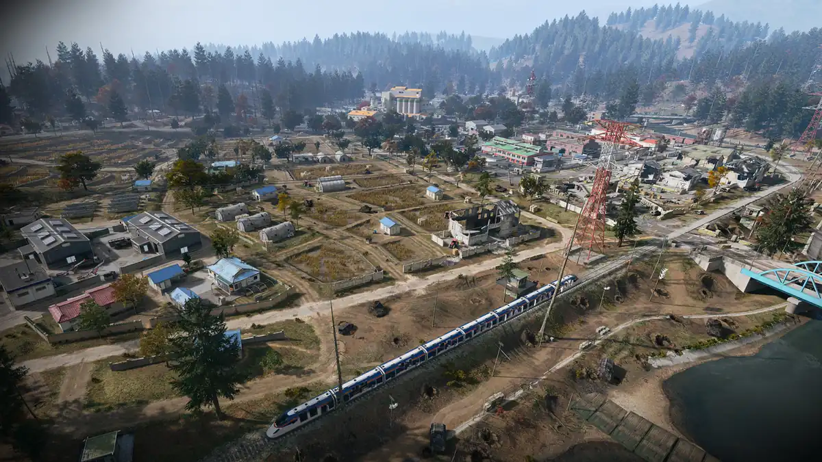
The farms occupy a low floodplain between the North and South Korean areas. Rice fields, waterways and scattered buildings break up the ground, while narrow roads and converging railway lines provide orientation. Open sightlines and limited cover are separate concerns from the area’s relatively low starting AI threat.
- Jeong Loading Dock: A Low-threat loading area within Imjin Farmland.
- Farmland Rice Mill: An elevated industrial site with silos and surrounding warehouses. Its Medium rating differs from the wider farmland.
Cheongun Village: Northern Hajin’s Quiet Gateway
The northern South Korean part of the DMZ map introduces players to Cheongun Village, a Low-threat area.
Expressway No. 1 follows the village’s southern perimeter. Wooded outskirts lie to the west, while the border-control area is on its eastern edge. The Heavenly Luck Casino has a High starting threat and dark interiors during power failures, despite the village’s Low rating.
- Cheongun Outskirts: Low-threat woodland west of the village, with fewer buildings and a nearby border-control post.
- Heavenly Luck Casino: This multi-story gambling hall presents both opportunities and challenges. Power failures darken the halls; the official guide recommends NVGs. The Casino includes underground parking as well as its gambling floors.
- Russian Border Crossing: The Low-threat border-control area at the village’s eastern edge. The Russian Border Crossing (East) map entry shows the checkpoint’s toll booths and abandoned vehicles.
- Russian Border: The fog-covered territory across the northern river is currently inaccessible.
Mirae General Hospital: A Hub of Medical and Strategic Importance
North-central Hajin hosts Mirae General Hospital, an area marked by its Low threat level but strategic importance due to medical supplies and tactical advantages.
With the expressway north and both the Mall and The Grid east, the hospital is a focal point for both players seeking healing and those looking to exploit its elevated position. Its triage tents offer temporary cover during engagements with enemy patrols or bandits.
The hospital grounds are stepped, with temporary barracks alongside the triage tents. Inside, the damaged multi-level lobby leads into waiting areas, patient rooms and emergency facilities. Colour-coded floor and stairwell signs provide more specific orientation than the Hospital name alone. Mujin Pass lies south of the district.
- Mirae memorial obelisk: Southeast of the main building, this garden area lies near the parking structure and train station.
Cheonwang Peak Array: The Telecommunications Hub
This Medium threat area dominates the central part of Hajin, featuring an array of telecommunications equipment and enemy barracks. Its strategic value lies in its elevated position, offering views over the surrounding terrain.
The Array’s DBN station has been occupied as enemy barracks. It is a separate site from DBN Headquarters, the television tower in The Grid. Keeping those two names apart matters when locating a destination: the mountain installation and the city high-rise belong to different areas.
- Rooftop Helipad: Overlooks the surrounding area.
- Granite Boulders & Woodland: Boulders lie west; woodland descends north toward Mujin Pass. Daesong Ridge is south of the Array’s official map anchor.
Haneul Nuclear Reactor: Contamination and Danger
North-eastern Hajin’s Haneul Nuclear Reactor is a High threat zone with concentrated radiation. The official guide recommends protective apparel and a gas mask.
The coastal complex contains different reactor buildings, a border zone and a boat-house landmark. The nearby Delta compound is southwest of the Reactor.
- South Korean Border Zone: The border area within the wider Reactor district starts at Medium threat, rather than inheriting the complex’s High tier.
- Reactor 01: Described as stable for now, within the wider contaminated complex. A separate starting threat tier is not supplied.
- Reactor 02: The containment breach centres on this reactor and its containment block.
- The Chemist’s Secure Armory bunker: The key tooltip names grid I4 and a secured bunker near the Reactor boat house. It gives a search area, without showing the doorway or confirming a boss spawn.
- Compound Delta: A nearby military site southwest of the Reactor. The guide describes a possible tunnel approach; its through-route has not yet been verified.
NuriGO Mall
This mixed-use area in northeastern Hajin City is divided into two main sections: East (Medium starting threat) and West (High). It features shops, civic buildings like the Clinic/Police station, and a monorail stop. The underground district can be accessed via an elevator near the old train station courtyard.
Hospital-side tenements lie west, a parkway runs north, the expressway continues east toward Donpyeong Gate, and The Grid sits south. Those surface streets and the underground shopping district are different parts of the same larger area.
- NuriGO East: The Medium-threat eastern part of the district.
- NuriGO West: The High-threat western part. Official footage also shows a Burger Town sign here.
- NuriGO underground shopping district: Look near the old train station for a courtyard with a pavilion and two light wells, one containing an elevator. Power loss leaves the sprawling shopping tunnels dark; NVGs are recommended.
- Han-Go Korean BBQ: A surface business visible in the official street views, identified by its ground-floor sign.
- City Hall: One of the Mall district’s surface civic buildings, with Donpyeong Gate nearby in the adjoining city description.
The Grid
The Grid is Hajin’s Critical-threat central business district. Tall buildings and raised transport routes sit behind steel-plated walls, razor wire, barricades and watchtowers. Fighting can extend from rooftops to streets, while damaged roads and railway structures complicate movement at ground level.
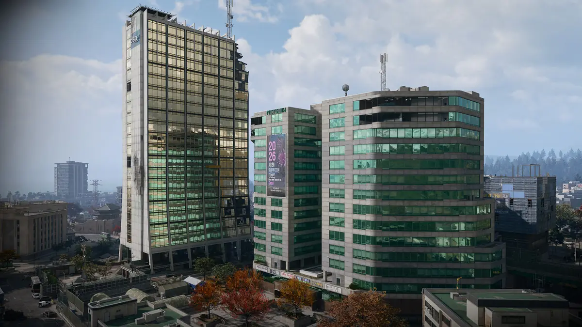
The southern edge facing Wolves Stadium is heavily held. Inside the district, the Nenshin Tech Complex raises the starting threat to Extreme.
- Nenshin Tech Complex: Extreme-threat twin high-rises with red roofs. Some source text uses the spelling Netshin; the named complex is the same reference here.
- DBN Headquarters: The Critical-threat DBN television tower, described as Hajin’s tallest building. It is not the DBN station at Cheonwang Peak Array.
- Hanex Bank: A Critical-threat bank tower near Donpyeong Gate and City Hall.
- Minsok Art School: A Critical-threat school beyond the damaged raised roadway and railway, beside a construction area.
- Construction Zone: Several eastern blocks under construction, with Critical starting threat.
- Donpyeong Gate: A historic fortification near City Hall and Hanex Bank, at the described extent of The Grid and the Mall’s eastern expressway.
- Hotel Lucera: A substantial building in the military-held sector, beyond a historic courtyard, pagoda and statue.
- Year of the Fire Horse statue: A landmark in the military-held area opposite Wolves Stadium, along the route past that courtyard and pagoda.
Songdo Wharf
Songdo Wharf is the Low-threat eastern waterfront. The nuclear coast lies north, the southern river fork helps define the district, and the expressway runs west. A tent market, shoreline park, pagodas and lighthouse distinguish it from the fortified streets of The Grid.
Both the train and monorail are described as active here. Stations, the pier and the northern apartment tower provide separate reference points along the coast. The tall apartment building is the tallest in this vicinity, rather than necessarily the tallest on the whole map.
- Oamsik Turtle Island: Low-threat rocky coastal islands beside Songdo Wharf, with a separate named map pin and cove view.
- Shoreline Station: A Low-threat station area within the Wharf district.
- La Grande Vie: The luxury apartment tower in northern Songdo Wharf, visibly named on its facade.
- Songdo Pier: The seaside pier, with covered docks and a lighthouse.
Wolves Stadium
Wolves Stadium occupies a Medium-threat south-central district around ruined baseball grounds. Damaged apartments, courtyards, shops, a bank and a Police Station surround the sporting venue. The northern boundary with The Grid is particularly dangerous, although that description is not an additional threat tier.
The wider Stadium district includes a concert venue and transport landmarks as well as the baseball grounds. Use those names to distinguish destinations within the district, rather than treating every Stadium reference as the playing field itself.
- Theatre: An abandoned open-air concert pavilion north of Wolves Stadium, with Medium starting threat.
- Baseball Stadium B Station: Marks the district’s northeastern corner, beside luxury apartments with collapsed upper floors.
- Ginyeom-il Bridge: Follow the elevated monorail southwest from the Stadium district toward the bridge, a ruined park and a nearby train station.
Hajin River Heights
Hajin River Heights is a Medium-threat residential district in the southeast, south of Wolves Stadium. Streets lined with shops rise toward the South Fork and a long green bridge. Apartment towers, ceremonial grounds, military occupation and wooded southern terrain give the district several distinct parts.
Compound Echo occupies an apartment building, while South Island is a separate wooded landmark beyond the Heights. The residential streets and the military-held apartment building therefore give you different destinations within the district.
- Jinseo Park Towers: Medium-threat residential towers near a ceremonial park in the southern Heights.
- South Island: A Medium-threat island beyond the district, with wooded slopes and a lone communications tower.
- Compound Echo: A military base in a commandeered apartment building, reached by following the riverside northeast.
Northern and Western Countryside
The northern countryside of Hajin features a variety of landmarks that players can explore during their missions. These villages, warehouses and Compounds sit between the major named areas; the groups here help you read their surroundings rather than define official district boundaries.
- Jayon Warehouses: A cluster of blue industrial buildings among rocky hills and trees in northwestern Hajin.
- Russian Border Crossing (West): Marked on the official map as a checkpoint with covered inspection lanes and a guard tower. This is a separate named checkpoint from the eastern crossing by Cheongun.
- Hanrim Village: A northern woodland village southeast of the western border crossing.
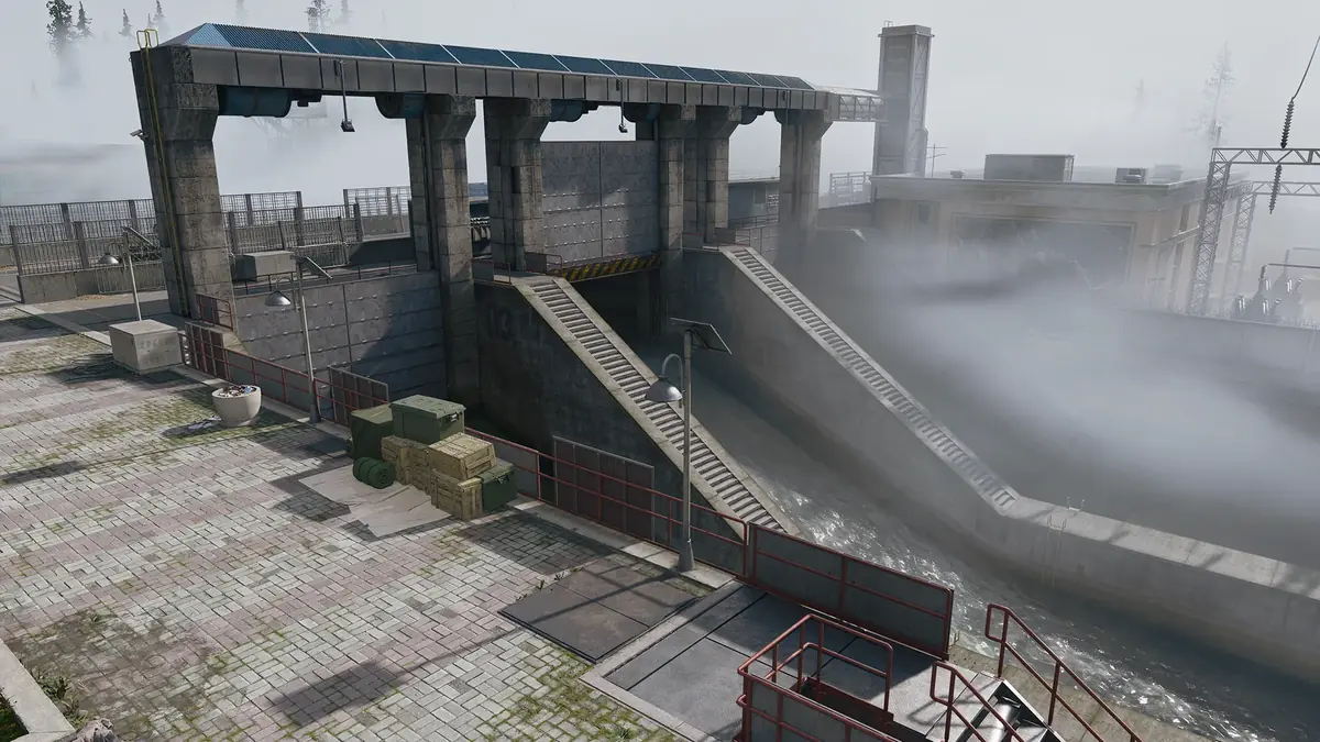
- Revolution Dam: An intact piece of infrastructure with a strong military-police presence. Tong-il Village lies just southeast, providing another nearby orientation point.
- Tong-il Village: A farming settlement on the northern river-delta floodplain. Its leader statue depicts an unnamed past leader with a raised fist, beside a tall monument.
- Compound Foxtrot: A wooded military site with green buildings and parked military trucks.
River Settlements, Ridges, and Southern Compounds
The southern regions of Hajin are characterized by their proximity to waterways and elevated terrain. Farms, road corridors and river crossings make these smaller places useful references between the larger districts.
- Pyonghwa Village: A farming hamlet west of the Hajin River, featuring a partially destroyed pontoon bridge. Its flat farmland is a different setting from the wooded high ground farther inland.
- Imjin Suburb: Located at the foot of a wooded hill near railway tracks, this hamlet lies beside the Hajin River.
- Mujin Pass: Farmland and a small community in a dell along a major road between two large forests. Mirae General Hospital lies north and Cheonwang Peak Array south.
- Daesong Ridge: A rural settlement northeast of Imjin Farmland and south of the Array’s map anchor. Burned-out APCs line a damaged roadway; their presence does not confirm usable vehicles.
- Burger Town at Daesong Ridge: Official footage shows a green, single-storey restaurant with front windows, menu posters and picnic tables. NuriGO West has another Burger Town sign, so this is not the only branch.
- Namjin Riverside: A southern location near the river’s South Fork, with abandoned civilian vehicles by an exit tunnel. That tunnel has not been established as an extraction service.
- Hajin River: Northern and southern tributaries run from the western mountains east and south, reaching the coast near the Reactor and Songdo Wharf.
- Compound Charlie: A military supply yard with storage buildings, crates, sandbags and watchtowers.
- Compound Alpha: A military compound among trees, with barracks, storage containers and defensive barriers.
- Compound Bravo: A camp with tents, defensive barriers and a guard tower.
Compounds are fortified military positions associated with increased resistance, improved loot and intel. The named sites are Alpha, Bravo, Charlie, Delta, Echo and Foxtrot. Their presence on the map does not give every compound an individually verified threat rating.
How do you reach Hajin’s underground areas?
The Air Base bunker, Deadtown sewers, Casino parking and NuriGO shopping tunnels are different underground spaces. There is no established continuous route connecting all of them, or confirmation that they form a separate Koschei-style match instance.
The clearest overview comes from the area-specific clues: large bunker doors on the Air Base’s southern hillside; the courtyard and elevator near NuriGO’s old train station; and underground parking at Heavenly Luck Casino. Deadtown’s sewer descriptions do not yet provide a complete entrance list. Near the Reactor, Compound Delta is a possible tunnel approach, while the Chemist key gives an I4 boat-house search clue.
Tank Depot
Tank Depot appears as a named tank-maintenance interior in the official development preview, with tanks and overhead lifting equipment visible during a Bale encounter. Its exact surface position and permanent threat classification have not been established. That appearance does not make it a guaranteed Bale spawn, a confirmed loot farm or a surveyed route from the Air Base.
Useful Buildings and Services
Each of Hajin’s services serves distinct purposes during missions. The current official map contains 89 distinct service points across eight categories. Loot buildings are places to search, rather than a guaranteed inventory of items.
The position lists below use compass directions relative to named landmarks. They are orientation references, rather than official building names, district boundaries or exact doors. Follow an individual entry for its PortalSpin locator; check the in-game Tac-Map for availability during your deployment. A nearby landmark name does not guarantee that the service is inside that landmark’s walls.
Where can you find medical supplies?
Clinics are green medical buildings where you can search for medical supplies. Their loot is an opportunity, rather than a guaranteed list of items or an automatic healing service. Mirae General Hospital is its own large district; a small green Clinic marker identifies a different type of destination.
The official map gives seven distinct Clinic positions:
- Clinic northwest of Tong-il Village
- Clinic northwest of Pyonghwa Village
- Clinic northeast of Chang-san Air Base
- Clinic southwest of Cheongun Village
- Clinic north of Imjin Suburb
- Clinic west of Daesong Ridge
- Clinic west of Wolves Stadium
Fire Stations and radiation gear
Look for radiation gear and parachutes in the red Fire Station buildings. Enemy presence is expected.
Six Fire Station positions are currently mapped:
- Fire Station south of Russian Border Crossing (West)
- Fire Station west of Pyonghwa Village
- Fire Station north of Deadtown
- Fire Station west of Cheongun Village
- Fire Station southwest of NuriGO East
- Fire Station northwest of Namjin Riverside
Police Stations and locked Armories
Blue Police buildings offer military-gear search opportunities and contain a locked Armory. An Armory is a room to locate, rather than the same thing as the ammunition-and-plate resupply cache. No single key that opens every Police Armory is established by the available information.
Five Police Station positions are mapped:
- Police Station southwest of Revolution Dam
- Police Station west of Pyonghwa Village
- Police Station north of Cheongun Village
- Police Station northeast of NuriGo Mall
- Police Station east of Wolves Stadium
Ammo & Armor Caches
Replenish ammunition and armor plates at these caches, with a cooldown before reuse. They serve a different purpose from searching a locked Armory. Exact cooldown lengths and refill quantities are not established here.
There are 28 mapped cache positions. The two northeast of Cheongun Village are separate points, distinguished below as western and eastern:
- Ammo & Armor Cache southwest of 14th Political Prison
- Ammo & Armor Cache north of Chang-san Air Base
- Ammo & Armor Cache northeast of Chang-san Air Base
- Ammo & Armor Cache southwest of Chang-san Air Base
- Ammo & Armor Cache northwest of Deadtown
- Ammo & Armor Cache east of Pyonghwa Village
- Ammo & Armor Cache north of Imjin Suburb
- Ammo & Armor Cache north of Cheongun Village
- Ammo & Armor Cache northeast of Cheongun Village (western)
- Ammo & Armor Cache northeast of Cheongun Village (eastern)
- Ammo & Armor Cache east of Cheongun Village
- Ammo & Armor Cache southwest of Mirae General Hospital
- Ammo & Armor Cache northeast of Haneul Nuclear Reactor
- Ammo & Armor Cache northwest of Haneul Nuclear Reactor
- Ammo & Armor Cache north of Shoreline Station
- Ammo & Armor Cache northeast of NuriGo Mall
- Ammo & Armor Cache east of Hanex Bank
- Ammo & Armor Cache southwest of Hanex Bank
- Ammo & Armor Cache south of The Grid
- Ammo & Armor Cache south of Construction Zone
- Ammo & Armor Cache east of Songdo Wharf
- Ammo & Armor Cache south of Wolves Stadium
- Ammo & Armor Cache southeast of Hajin River Heights
- Ammo & Armor Cache north of Imjin Farmland
- Ammo & Armor Cache southwest of Daesong Ridge
- Ammo & Armor Cache south of Daesong Ridge
- Ammo & Armor Cache southwest of Imjin Farmland
- Ammo & Armor Cache southeast of Imjin Farmland
Gas Stations
Gas Stations repair and refuel ground and airborne vehicles, and refill carried Gas Cans. The service matters when choosing a journey across the map, since vehicles need both fuel and repairs.
The current map lists 18 Gas Station positions:
- Gas Station west of Revolution Dam
- Gas Station northeast of Pyonghwa Village
- Gas Station southwest of Pyonghwa Village
- Gas Station north of Deadtown
- Gas Station west of Deadtown
- Gas Station northwest of Namjin Riverside
- Gas Station east of Namjin Riverside
- Gas Station south of Cheongun Outskirts
- Gas Station southwest of Russian Border Crossing (East)
- Gas Station south of Russian Border Crossing (East)
- Gas Station south of Imjin Suburb
- Gas Station northeast of Cheonwang Peak Array
- Gas Station west of NuriGO West
- Gas Station northeast of NuriGo Mall
- Gas Station southeast of Daesong Ridge
- Gas Station southwest of Wolves Stadium
- Gas Station south of Construction Zone
- Gas Station northeast of Songdo Wharf
Marine Gas Stations
Marine Gas Stations provide waterside repair and refuelling for boats. Carefully positioned land and air vehicles can also use them, so they are not boat-only services. The available description does not establish the exact positioning requirement for every vehicle.
Six waterside service points are mapped:
- Marine Gas Station southeast of Russian Border Crossing (West)
- Marine Gas Station northeast of Cheongun Village
- Marine Gas Station east of Haneul Nuclear Reactor
- Marine Gas Station north of Songdo Pier
- Marine Gas Station southwest of Hajin River Heights
- Marine Gas Station southwest of South Island
UAV Towers
UAV Towers allow players to activate detection pulses for nearby enemies and Operators. Activating one also completes a Side Op and awards DMZ Cash. No detection radius or duration is established here. Keep this separate from a Lieutenant Hunt tower, which identifies a nearby boss target rather than providing the same general detection function.
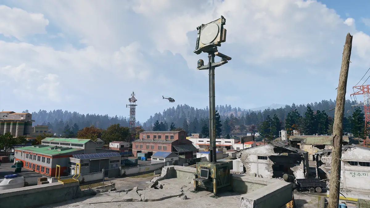
Fourteen UAV Tower positions are mapped:
- UAV Tower southwest of 14th Political Prison
- UAV Tower northwest of Chang-san Air Base
- UAV Tower north of Deadtown
- UAV Tower north of Imjin Farmland
- UAV Tower northwest of Namjin Riverside
- UAV Tower northwest of Cheongun Village
- UAV Tower west of Russian Border Crossing (East)
- UAV Tower east of Russian Border Crossing (East)
- UAV Tower southeast of Mirae General Hospital
- UAV Tower northeast of NuriGo Mall
- UAV Tower northwest of Cheonwang Peak Array
- UAV Tower southwest of Wolves Stadium
- UAV Tower east of Hajin River Heights
- UAV Tower southeast of Songdo Wharf
Lieutenant Hunt towers
Climb to the Upload Station to mark the closest Lieutenant for your squad. The tower does not promise a chosen named boss, so finding the tower and finding the Lieutenant are separate steps.
Five Lieutenant Hunt tower positions are mapped:
- Lieutenant Hunt Tower north of Tong-il Village
- Lieutenant Hunt Tower southwest of Deadtown
- Lieutenant Hunt Tower south of Russian Border Crossing (East)
- Lieutenant Hunt Tower northwest of Wolves Stadium
- Lieutenant Hunt Tower northeast of South Island
Bounty Stations and SAM Sites
Bounty Station laptops let you review Operator bounties or pay off your own using DMZ Cash. They are a separate service from either kind of tower. Their function is known, but a complete list of current, individually verified station positions is not available in the official public map’s marker set.
SAM Sites are fixed anti-aircraft batteries. Hack the control computer and defend the site to capture it; the battery then targets hostile aircraft, including Deathstalkers. Moving far away can allow enemies to retake it. The current public map does not provide a dedicated SAM-position layer, so precise site locations should not be inferred from unrelated tower or compound markers.
Roads, Rivers and Travel Across Hajin
Expressway No. 1 is the main freeway across Hajin. It gives you a broad road reference between districts, while local roads lead into farms, settlements and military sites. Road access and starting threat are different questions: a large road does not establish a safe route through an occupied district.
The automated Train follows a winding route through South Korean points of interest. An elevated Tram or monorail circles the city perimeter, giving the city stations and raised line their own role in reading the map. At Wolves Stadium, that line continues southwest toward Ginyeom-il Bridge; at Songdo Wharf, both train and monorail are described as active.
The Hajin River’s tributaries run from the western mountains toward the Reactor and Songdo coast. Bridges, pontoon crossings and the long southern green bridge help orient movement between banks. Check the actual crossing in front of you: a damaged bridge is not proof of an intact vehicle route, and a parked or abandoned vehicle is not necessarily usable.
Gas and Marine Gas Stations belong in that journey planning alongside the roads and waterways. Their individual locators above let you find a nearby service without assuming every rural landmark has fuel or repairs.
Exfil Locations and Extraction
DMZ exfil sites are selected from a pool, with active sites marked by green smoke. Call the extraction helicopter, hold the site and board when it arrives. The official guide also names Flare and Fulton alternatives, but they should not be treated as fixed exits guaranteed at every named landmark.
Are exfil locations the same every deployment? Do not assume a particular site will be active each time. Use your current Tac-Map and watch the radiation countdown as conditions worsen. The public interactive map is not a complete inventory of active player exits or starting infil locations.
An official development Tac-Map view shows two extraction icons around the river and Imjin Suburb, one on each bank. Those are examples from the pictured deployment, rather than a complete launch pool or a promise that either point will always be available. Likewise, a rooftop helipad, the Namjin exit tunnel or a lighthouse by itself does not confirm a general player exfil service.
Use the district names to choose where you want to go, the service markers to support the journey, and the active extraction information to decide how you will leave. Recheck your exit as the deployment changes, rather than treating a familiar place name as a guaranteed way home.